“ProximiT” Reimagined
01.
The Problem
Many of us struggle navigating the T system… Even with the help of a navigation app, it can still be difficult and misleading. With unreliable and tight schedules of the T, understanding the rail line could help improve the everyday commute and travel using public transportation.
02.
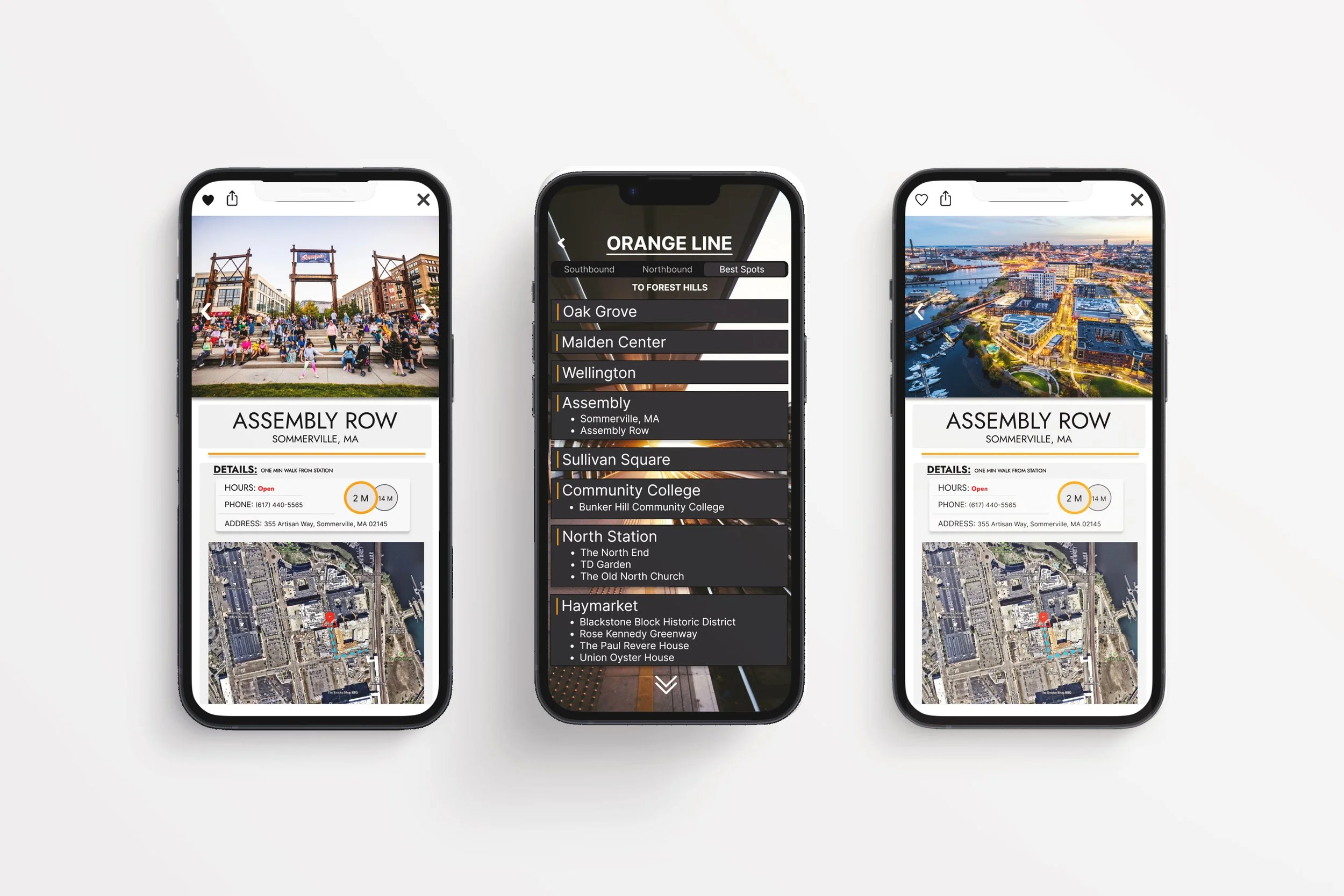

I began moving these ideas digital. The ProximiT contained Southbound and Northbound schedules and updates. I added an additional tab to this section: Best Spots. For each stop there are nearby attractions listed.

04.
Prototyping
The Solution:
Using Figma, I redesigned the Orange Line to provide information about nearby attractions and points of interest located near MBTA stops. Through increased connection to the city’s attributes, both everyday users of the T and even tourist can more easily navigate the system.
05.
The Objective
Through enhancing the MBTA, T users will be able to gain a greater knowledge of the Boston area through association of their favorite spots around town with specific T stops. Through increasing visibility and accessibility to information of their local environment, users can explore easier and connect to their surroundings when using public transportation.
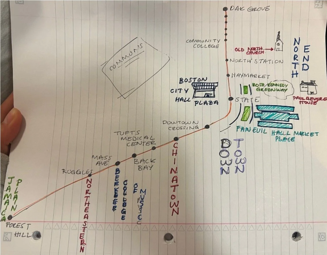
03.
Ideation
I decided to focus solely on the Orange Line for contextualizing the map. I began by sketching the line in relation to the city and its nearby attractions. I began thinking of apps to alter to incorporate these qualities, ultimately landing on ProximiT.